Page History
...
- To load a WMS Layer go to the Images and Maps link in Administration. Select the WMS Layer image type and enter the server details as per your WMS server. Click the
 Load Layers link to view all the WMS layers on the server.
 - You should now have a list of layers that you can preview and save by selecting the checkbox next to a layer and then clicking the Preview and Save links.
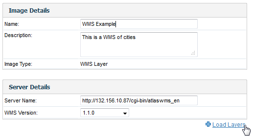
- Once saved, you should then see the WMS layer listed on your Images and Maps list.
Add WMS Layer
| Styleclass | ||
|---|---|---|
| ||
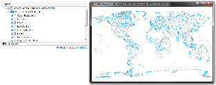
- When you have created a GIS map using the chart builder, click on the Add Layer link at the bottom of the Chart Data section.

- You will then see the Layer popup window, from which you can select your WMS Layer and click Add.

- Your report should now have a WMS Layer added, like the one pictured below.

| horizontalrule |
|---|
| Styleclass | ||
|---|---|---|
| ||